-
Title
-
Miedzyzdroje-Wiselka Cliff GEOSITE
-
Description
-
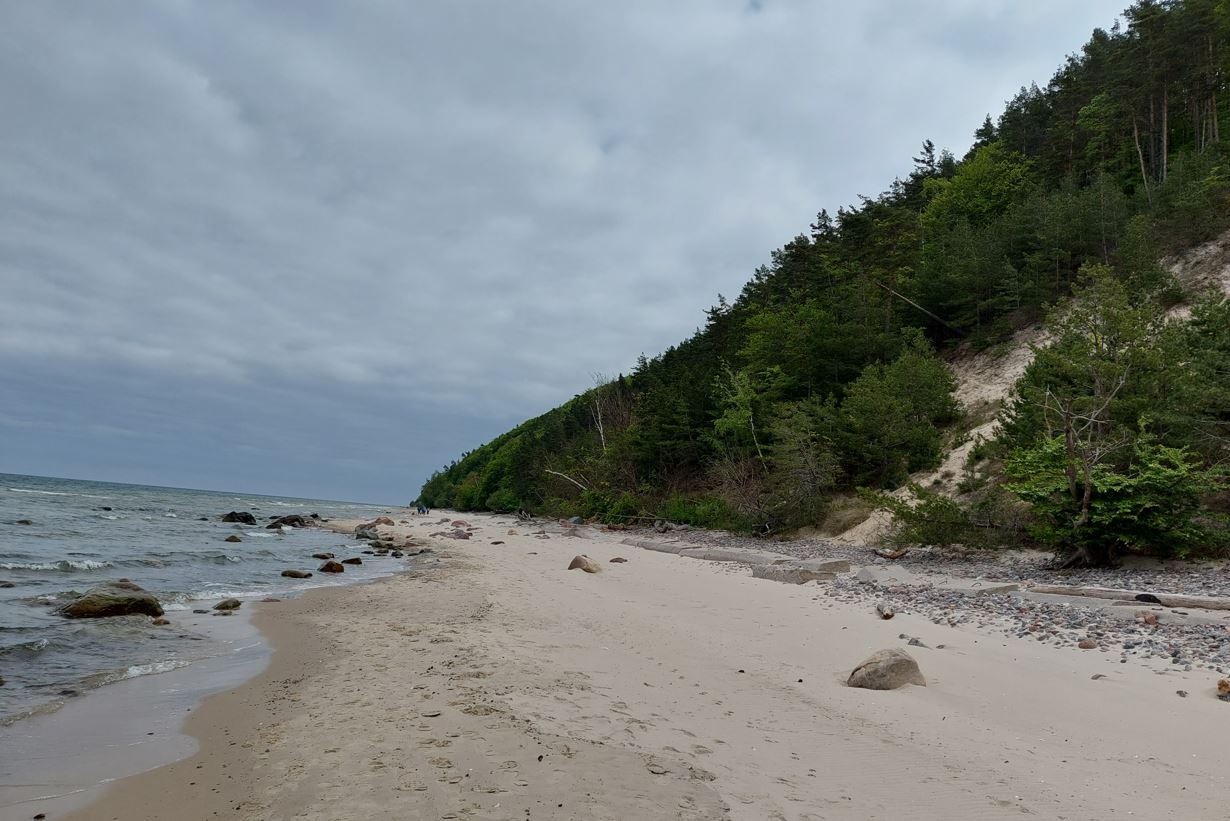
These cliffs stretch for about 11 km east of Międzyzdroje. They constitute the northern edge of the moraine and kame hills of the Woliński Range, formed by the receding ice sheet of the Pomeranian phase of the Baltic glaciation (the Vistula glaciation, northern Poland). These are the highest cliffs in Poland. Mount Gosań, which is also the highest point of the Polish coast, is nearly 95 m above sea level. around Grodno and further towards Wisełka. The average slope of the cliff slopes in this section is about 50 degrees. Two levels of boulder clays (moraine) can be observed in the cliff profile: the lower one, gray in color, up to 40 m thick, associated with the Warta glaciation (Middle Polish, approx. 210,000 years ago) and the upper - younger, yellow-brown in color, up to 3 m thick, associated with the youngest thrust of the ice sheet on this area (Vistula glaciation, North Polish, Pomeranian phase of the glaciation Baltic, 14-12 thousand years ago). They are covered with a series of fluvioglacial (fluvioglacial) sandy and gravel formations of varying thickness, and a series of aeolian sands (2-15 m) on its surface. Just above the beach level, there is a burst of gray marls of the Cretaceous period, i.e. a large block of rock cut from the ground by the ice sheet, displaced for a certain distance and deposited within the post-glacial sediments. There are numerous marcasite concretions (assemblies). On the cliff, apart from analyzing the geological structure, you can observe contemporary sculptural processes shaping the seashore. The cliff in this section is a "living" cliff (active, active), and therefore subject to the influence of sea waves, wind and constant changes. In many places it creates an almost vertical edge with a distinct abrasion niche (edge undercut) at the base. Cliff shores can be divided into: landslide-runoff type (in the zone where sands, gravels and inter-moraine silts with groundwater exudation occur between the level of compact boulder clays), fall-off type (on slopes built mainly of compact boulder clay) and scree type ( composed largely of thick series of fluvioglacial sand and gravel sediments devoid of groundwater). All the above-mentioned types of cliffs can be observed in the Międzyzdroje-Wisełka section. In this cliff, in its sandy and gravel part, there are mostly landslides. In places where there are sands or gravels in the substrate, this material loses its compactness after drying and begins to crumble under the influence of gravity, creating characteristic heap cones. The "tongues" of sand slide systematically and continuously, although with different frequency and speed, their shape also changes. With a steeply sloping slope, vegetation cannot settle the moving and constantly sliding sand. Extensive sandy cones often mask the structure of the cliff in the lower parts. On the other hand, when the substrate is very moist, slides, landslides or runoff of the plasticized clay mass are formed. Very wet formations (dust, clay, and even fine-grained sands) then begin to flow down the slope, creating long, muddy "tongues", flowing often across the beach to the sea. Their color, depending on the content of clay or dust, is usually gray or brown. When the aquifer is exposed, water seeps constantly. The most characteristic of boulder clays are the falls of large blocks. They are often caused by various climatic factors, most often rains and frosts, as well as by "undercutting" by sea waves. Abrasion, i.e. the destruction and retreat of the cliff, causes that it has an almost vertical profile in many places along this section. As a result of landslides and landslides, characteristic "steps" are formed, and often whole undisturbed patches of grassy grasslands, thickets and even clumps of trees fall down. When the aquifer is exposed, water seeps constantly. The most characteristic of boulder clays are the falls of large blocks. They are often caused by various climatic factors, most often rains and frosts, as well as by "undercutting" by sea waves. Abrasion, i.e. the destruction and retreat of the cliff, causes that it has an almost vertical profile in many places along this section. As a result of landslides and landslides, characteristic "steps" are formed, and often whole undisturbed patches of grassy grasslands, thickets and even clumps of trees fall down. When the aquifer is exposed, water seeps constantly. The most characteristic of boulder clays are the falls of large blocks. They are often caused by various climatic factors, most often rains and frosts, as well as by "undercutting" by sea waves. Abrasion, i.e. the destruction and retreat of the cliff, causes that it has an almost vertical profile in many places along this section. As a result of landslides and landslides, characteristic "steps" are formed, and often whole undisturbed patches of grassy grasslands, thickets and even clumps of trees fall down. means the destruction and retreat of the cliff, causes that it has in many places on this section an almost vertical profile. As a result of landslides and landslides, characteristic "steps" are formed, and often whole undisturbed patches of grassy grasslands, thickets and even clumps of trees fall down. means the destruction and retreat of the cliff, causes that it has in many places on this section an almost vertical profile. As a result of landslides and landslides, characteristic "steps" are formed, and often whole undisturbed patches of grassy grasslands, thickets and even clumps of trees fall down
-
Lithology
-
clay
-
sand
-
gravel
-
Landform shape
-
Glacial - Frontal moraine
-
Event environment
-
glacier related setting
-
glacial outwash plain setting
-
Older numeric age
-
210000
-
Younger numeric age
-
12000
-
Interest
-
Glaciological
-
Geomorphological
 MWcliff.JPG